Introduction
Have you ever noticed how new fast-food restaurants, coffee shops, or retail stores seem to pop up in just the right places? This isn’t luck — it’s data-driven decision-making powered by Geographic Information Systems (GIS) and consumer movement data.
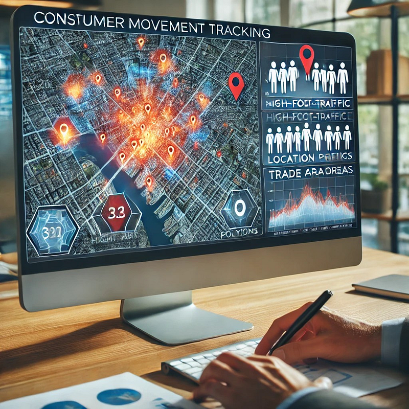
Businesses today are using geospatial analytics to understand where people go, how they move, and what influences their choices. This insight helps them optimize store locations, marketing strategies, and logistics.
Let’s explore how GIS is revolutionizing consumer movement analysis and why it matters for businesses.
1️⃣ What is Consumer Movement Data?
Consumer movement data refers to location-based insights collected from:
- 📍 Mobile GPS & App Data (tracking foot traffic patterns).
- 📡 WiFi & Bluetooth Signals (detecting device presence in stores).
- 🛰 Satellite & Aerial Imagery (analyzing urban movement trends).
- 🚗 Transportation Data (public transit, ride-sharing patterns).
Businesses use this anonymized data to answer questions like:
- Where do potential customers live, work, and shop?
- How far are they willing to travel for a purchase?
- Which competitor locations get more traffic?
💡 Example: A fast-food chain can track where customers go before and after visiting their restaurant, helping them choose better locations for expansion.
2️⃣ How Businesses Use GIS for Consumer Movement Analysis
🔹 1. Site Selection: Finding the Best Store Locations
Opening a new store is a huge investment — picking the wrong location can be costly. Businesses use GIS to:
- Analyze foot traffic density to find high-traffic zones.
- Identify customer demographics (age, income, spending habits).
- Assess competitor proximity (too close = high competition, too far = missed opportunity).
📍 Example: Starbucks uses GIS to analyze morning commute patterns, ensuring stores are placed along busy work routes.
🔹 2. Trade Area Mapping: Understanding Customer Reach
A trade area is the region where most of a store’s customers live or work. Businesses use GIS to:
- Draw buffer zones (e.g., 5-mile radius around a store).
- Use drive-time analysis to estimate how far people will travel.
- Identify customer leakage (areas where customers go elsewhere).
📍 Example: A supermarket chain uses GIS-based heatmaps to visualize which neighborhoods shop at their store vs. competitors.
🔹 3. Competitive Intelligence: Tracking Rivals’ Success
Businesses don’t just analyze their own locations — they monitor competitor movement data too.
- GIS helps map competing store locations and customer flow.
- Businesses analyze which brands attract more visitors.
- Insights help adjust pricing, promotions, and store placement.
📍 Example: A gym brand tracks foot traffic around competitor gyms to identify untapped neighborhoods for expansion.
🔹 4. Consumer Behavior Prediction: Forecasting Demand
Predictive modeling + GIS helps businesses anticipate future customer trends.
- Machine learning models analyze movement patterns.
- Stores can forecast demand and adjust inventory.
- Retailers optimize marketing campaigns based on real-time movement.
📍 Example: A clothing brand uses GIS to target ads in neighborhoods where shoppers frequently visit competitor stores.
3️⃣ How GIS Tools Analyze Consumer Movement
Businesses use GIS software and Python libraries to process movement data.
🔹 ArcGIS Pro & QGIS (GIS Software)
✅ ArcGIS Pro — Advanced consumer movement mapping
✅ QGIS — Free, open-source alternative
💡 Example: A GIS analyst uses ArcGIS Pro’s Hot Spot Analysis to find high-foot-traffic areas for a new café.
🔹 Python for Movement Data Analysis
Python helps automate consumer movement analysis.
Example: Automating Movement Data Processing in ArcGIS Pro
import arcpy

# Input movement dataset
input_points = "C:/GIS/movement_data.shp"

# Perform Kernel Density Estimation
output_density = "C:/GIS/movement_density.tif"
arcpy.sa.KernelDensity(input_points, None, output_density, 100)
print("Density analysis completed!")
🔹 Results? Businesses visualize foot traffic density to pinpoint ideal store locations.
4️⃣ Ethical Considerations in Consumer Movement Tracking
While movement data is valuable, businesses must handle it ethically.
- ✅ Anonymization — No personal identification.
- ✅ Transparency — Inform users if data is collected.
- ✅ Privacy Compliance — Follow regulations (GDPR, CCPA).
💡 Example: Apple & Google ensure mobile tracking is opt-in only to protect user privacy.
Conclusion: The Future of GIS in Consumer Analytics
The way businesses track customer movement is evolving rapidly. Real-time GIS, AI-powered analytics, and interactive mapping will make decision-making even smarter.
🔗 Useful Resources & Links
- 📍 OpenStreetMap Movement Data
- 🗺 ArcGIS Trade Area Analysis
- 💡 How Google Uses Location Data
Originally published on Medium.
