[GDS] Geospatial Data Science 101: The Dark Side of Location Data: Privacy and Ethical Concerns in GIS


Introduction

Every time you use a navigation app, check the weather, or shop online, your location data is being collected. Businesses and governments use Geographic Information Systems (GIS) to improve services, but at what cost?

While GIS has transformed industries like retail, transportation, and healthcare, it also raises serious privacy and ethical concerns. How much do companies really know about our movements? And are we willingly giving away too much information?

In this article, we’ll explore:
✅ How location data is collected
✅ The risks of geospatial tracking
✅ The ethical challenges of GIS
✅ How we can protect our privacy


1️⃣ How Location Data is Collected

Location data comes from multiple sources, often without users fully realizing it.

📌 Common Location Data Sources:
Mobile Apps — Social media, fitness trackers, weather apps.
GPS Devices — Smartphones, smartwatches, car navigation.
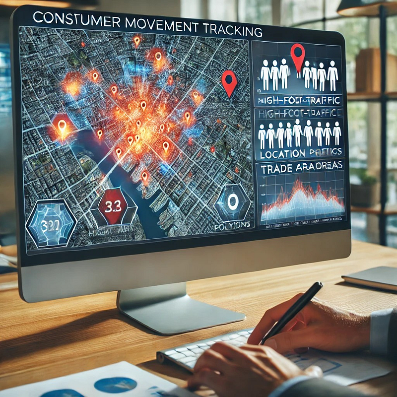
Wi-Fi & Bluetooth Signals — Stores track foot traffic via Wi-Fi.
CCTV & Drones — Cities monitor public spaces.
Credit Card Transactions — Banks log locations of purchases.

💡 Example: A grocery store uses Wi-Fi tracking to analyze customer movement patterns and optimize store layout.


2️⃣ The Risks of Location Tracking

🔹 1. Loss of Personal Privacy

Many apps collect precise location data, even when they don’t need it.

📌 Risk: Your daily routines (home, work, gym) are tracked and stored, creating a detailed digital footprint.

💡 Example: A weather app was found selling user location data to third-party advertisers without consent.


🔹 2. Selling & Misusing Location Data

Your location data is valuable — it’s often bought and sold without your knowledge.

📌 Risk: Companies collect data from apps and sell it to advertisers, insurance firms, or law enforcement.

💡 Example: A ride-sharing app sold anonymous location data to real estate developers for market analysis.


🔹 3. Government Surveillance & Tracking

Governments use GIS & big data to monitor citizens, sometimes crossing ethical lines.

📌 Risk: Increased mass surveillance, predictive policing, and loss of anonymity.

💡 Example: Some cities use AI-powered CCTV + GIS to track individuals’ movements in real-time.


🔹 4. Location Data & Cybersecurity Risks

📌 Risk: If a database of geolocation data is hacked, sensitive travel patterns, home addresses, and business locations can be exposed.

💡 Example: A fitness tracking app accidentally revealed the locations of military bases, as soldiers’ jogging routes were mapped online.


3️⃣ Ethical Challenges in GIS & Location Data

Using GIS responsibly requires ethical considerations:

Consent & Transparency — Are users informed when their location is being tracked?
Data Ownership — Who controls collected location data — users or companies?
Bias & Discrimination — Does GIS reinforce inequality (e.g., redlining in real estate)?
Security — Is sensitive geospatial data properly protected?

💡 Example: Some insurance companies charge higher rates based on ZIP codes, which can reinforce economic inequality.


4️⃣ How to Protect Your Location Privacy

🔹 1. Turn Off Unnecessary Location Services
📌 Solution: Disable location tracking for apps that don’t need it (e.g., weather apps).

🔹 2. Use a VPN
📌 Solution: Hide your IP address to prevent location-based tracking.

🔹 3. Read App Privacy Policies
📌 Solution: Check if an app shares or sells your location data.

🔹 4. Disable Wi-Fi & Bluetooth When Not in Use
📌 Solution: Prevent retail stores from tracking your phone’s signals.

🔹 5. Choose Privacy-Focused Maps
📌 Solution: Use open-source maps like OpenStreetMap instead of commercial services that log your data.

💡 Example: Some privacy-conscious users prefer DuckDuckGo Maps over Google Maps to avoid data tracking.


5️⃣ The Future of Ethical GIS

As GIS technology evolves, governments and businesses must:
✅ Implement stronger data protection laws.
✅ Use anonymous geospatial data whenever possible.
✅ Be transparent about data collection & sharing.

🚀 Emerging Trends:
✅ AI-driven privacy filters for location data.
✅ Increased use of blockchain for secure GIS data storage.
✅ Stricter GDPR-style privacy laws worldwide.

💡 Example: Apple’s iOS now requires apps to ask for location tracking permissions, giving users more control.


Conclusion: Balancing Innovation & Privacy

GIS is revolutionizing industries, but it must be used responsibly.

Location data is powerful, but also risky.
Businesses and governments must ensure ethical use.
Users should take steps to protect their own privacy.


🔗 Useful Resources & Links

Originally published on Medium.

[GDS] Geospatial Data Science 101: How Companies Use GIS for Smarter Business Decisions


Introduction

Location matters in business. Whether it’s choosing the perfect store location, optimizing delivery routes, or targeting the right customers, Geographic Information Systems (GIS) play a crucial role in modern business intelligence.

GIS isn’t just about maps — it’s about data-driven decision-making. By analyzing location data, businesses can gain valuable insights, improve efficiency, and gain a competitive advantage.

In this article, we’ll explore:
✅ How businesses use GIS for decision-making
✅ Key GIS applications in different industries
✅ Real-world examples of GIS success in business


1️⃣ Why GIS is a Game Changer for Business

Traditional business analytics rely on sales reports, customer surveys, and spreadsheets. But GIS adds a powerful spatial dimension, answering questions like:

📌 Where are our best customers located?
📌 Which delivery routes are the most efficient?
📌 Where should we open our next store?
📌 How does weather impact our sales?

💡 Example: A fast-food chain uses GIS to analyze customer foot traffic and identify high-potential locations for new restaurants.


2️⃣ Top Business Applications of GIS

🔹 1. Site Selection & Market Expansion

Choosing the right location is critical for retail, restaurants, and real estate.

📊 How GIS Helps:
✅ Analyzes population density & income levels.
✅ Identifies competitor locations.
✅ Uses drive-time analysis to determine accessibility.

💡 Example: Starbucks uses GIS to predict store performance based on foot traffic, demographics, and economic trends.


🔹 2. Customer Demographics & Targeted Marketing

Understanding who your customers are and where they live helps businesses run more effective marketing campaigns.

📊 How GIS Helps:
✅ Segments customers based on location, income, and behavior.
✅ Identifies high-value neighborhoods for advertising.
✅ Optimizes billboard and digital ad placements.

💡 Example: A clothing brand uses GIS to map customer purchases and target ads to high-spending areas.


🔹 3. Supply Chain & Logistics Optimization

Companies rely on GIS to streamline shipping, deliveries, and supply chains.

📊 How GIS Helps:
✅ Optimizes warehouse placement based on demand.
✅ Identifies the fastest and cheapest delivery routes.
✅ Uses real-time tracking to monitor shipments.

💡 Example: Amazon uses GIS + AI to predict package delivery times and adjust routes dynamically based on traffic and weather conditions.


🔹 4. Risk Management & Disaster Planning

GIS helps businesses assess risks and plan for natural disasters, economic downturns, and supply chain disruptions.

📊 How GIS Helps:
✅ Identifies flood zones, wildfire risks, and earthquake-prone areas.
✅ Maps historical weather patterns to predict impact on sales.
✅ Supports emergency response planning.

💡 Example: Insurance companies use GIS to assess flood risk levels and set policy rates accordingly.


3️⃣ How Businesses Use GIS Data Sources

Businesses integrate GIS with big data sources such as:
Census Data — Customer demographics & income levels.
Satellite Imagery — Land-use changes & environmental risks.
Mobile GPS Data — Consumer movement tracking.
Weather & Climate Data — Forecasting business impact.

💡 Example: A ski resort uses GIS weather data to predict snowfall and optimize ticket pricing.


4️⃣ Real-World Example: How McDonald’s Uses GIS for Site Selection

McDonald’s has over 40,000 locations worldwide — but how do they choose where to open a new restaurant?

📌 How McDonald’s Uses GIS:
Analyzes customer traffic patterns (who visits & where they come from).
Uses demographic data (income, family size, eating habits).
Studies competitor presence (avoiding oversaturation).
Performs drive-time analysis (how far customers travel for food).

Result? Smarter store placement, higher sales, and faster expansion!


5️⃣ How to Get Started with GIS for Business

1️⃣ Identify Your Business Question — Do you need help with site selection? Logistics? Marketing?
2️⃣ Collect & Analyze Data — Use census data, sales reports, GPS tracking, and more.
3️⃣ Visualize Insights with GIS Maps — Heatmaps, trade area analysis, and spatial clustering.
4️⃣ Automate GIS Workflows — Use Python (ArcPy, GeoPandas) to streamline processes.
5️⃣ Make Data-Driven Decisions — Use GIS insights to improve business strategies.

💡 Example: A startup uses GIS + Python to automate customer location analysis, reducing research time from weeks to minutes!


Conclusion: GIS = Smarter Business Decisions

GIS is no longer optional — it’s a must-have for businesses looking to:
Optimize store locations
Improve logistics & deliveries
Target the right customers
Assess risks & make smarter decisions


🔗 Useful Resources & Links

Originally published on Medium.

[GDS] Geospatial Data Science 101: How Businesses Use GIS to Track Consumer Movement


Introduction

Have you ever noticed how new fast-food restaurants, coffee shops, or retail stores seem to pop up in just the right places? This isn’t luck — it’s data-driven decision-making powered by Geographic Information Systems (GIS) and consumer movement data.

Businesses today are using geospatial analytics to understand where people go, how they move, and what influences their choices. This insight helps them optimize store locations, marketing strategies, and logistics.

Let’s explore how GIS is revolutionizing consumer movement analysis and why it matters for businesses.


1️⃣ What is Consumer Movement Data?

Consumer movement data refers to location-based insights collected from:

  • 📍 Mobile GPS & App Data (tracking foot traffic patterns).
  • 📡 WiFi & Bluetooth Signals (detecting device presence in stores).
  • 🛰 Satellite & Aerial Imagery (analyzing urban movement trends).
  • 🚗 Transportation Data (public transit, ride-sharing patterns).

Businesses use this anonymized data to answer questions like:

  • Where do potential customers live, work, and shop?
  • How far are they willing to travel for a purchase?
  • Which competitor locations get more traffic?

💡 Example: A fast-food chain can track where customers go before and after visiting their restaurant, helping them choose better locations for expansion.


2️⃣ How Businesses Use GIS for Consumer Movement Analysis

🔹 1. Site Selection: Finding the Best Store Locations

Opening a new store is a huge investment — picking the wrong location can be costly. Businesses use GIS to:

  • Analyze foot traffic density to find high-traffic zones.
  • Identify customer demographics (age, income, spending habits).
  • Assess competitor proximity (too close = high competition, too far = missed opportunity).

📍 Example: Starbucks uses GIS to analyze morning commute patterns, ensuring stores are placed along busy work routes.


🔹 2. Trade Area Mapping: Understanding Customer Reach

A trade area is the region where most of a store’s customers live or work. Businesses use GIS to:

  • Draw buffer zones (e.g., 5-mile radius around a store).
  • Use drive-time analysis to estimate how far people will travel.
  • Identify customer leakage (areas where customers go elsewhere).

📍 Example: A supermarket chain uses GIS-based heatmaps to visualize which neighborhoods shop at their store vs. competitors.


🔹 3. Competitive Intelligence: Tracking Rivals’ Success

Businesses don’t just analyze their own locations — they monitor competitor movement data too.

  • GIS helps map competing store locations and customer flow.
  • Businesses analyze which brands attract more visitors.
  • Insights help adjust pricing, promotions, and store placement.

📍 Example: A gym brand tracks foot traffic around competitor gyms to identify untapped neighborhoods for expansion.


🔹 4. Consumer Behavior Prediction: Forecasting Demand

Predictive modeling + GIS helps businesses anticipate future customer trends.

  • Machine learning models analyze movement patterns.
  • Stores can forecast demand and adjust inventory.
  • Retailers optimize marketing campaigns based on real-time movement.

📍 Example: A clothing brand uses GIS to target ads in neighborhoods where shoppers frequently visit competitor stores.


3️⃣ How GIS Tools Analyze Consumer Movement

Businesses use GIS software and Python libraries to process movement data.

🔹 ArcGIS Pro & QGIS (GIS Software)

ArcGIS Pro — Advanced consumer movement mapping
QGIS — Free, open-source alternative

💡 Example: A GIS analyst uses ArcGIS Pro’s Hot Spot Analysis to find high-foot-traffic areas for a new café.


🔹 Python for Movement Data Analysis

Python helps automate consumer movement analysis.

Example: Automating Movement Data Processing in ArcGIS Pro

import arcpy

# Input movement dataset
input_points = "C:/GIS/movement_data.shp"

# Perform Kernel Density Estimation
output_density = "C:/GIS/movement_density.tif"
arcpy.sa.KernelDensity(input_points, None, output_density, 100)
print("Density analysis completed!")

🔹 Results? Businesses visualize foot traffic density to pinpoint ideal store locations.


4️⃣ Ethical Considerations in Consumer Movement Tracking

While movement data is valuable, businesses must handle it ethically.

  • Anonymization — No personal identification.
  • Transparency — Inform users if data is collected.
  • Privacy Compliance — Follow regulations (GDPR, CCPA).

💡 Example: Apple & Google ensure mobile tracking is opt-in only to protect user privacy.


Conclusion: The Future of GIS in Consumer Analytics

The way businesses track customer movement is evolving rapidly. Real-time GIS, AI-powered analytics, and interactive mapping will make decision-making even smarter.


🔗 Useful Resources & Links

Originally published on Medium.